Analysis · · Peter Hanlon
Franchise Mapping
Franchise mapping the hard way
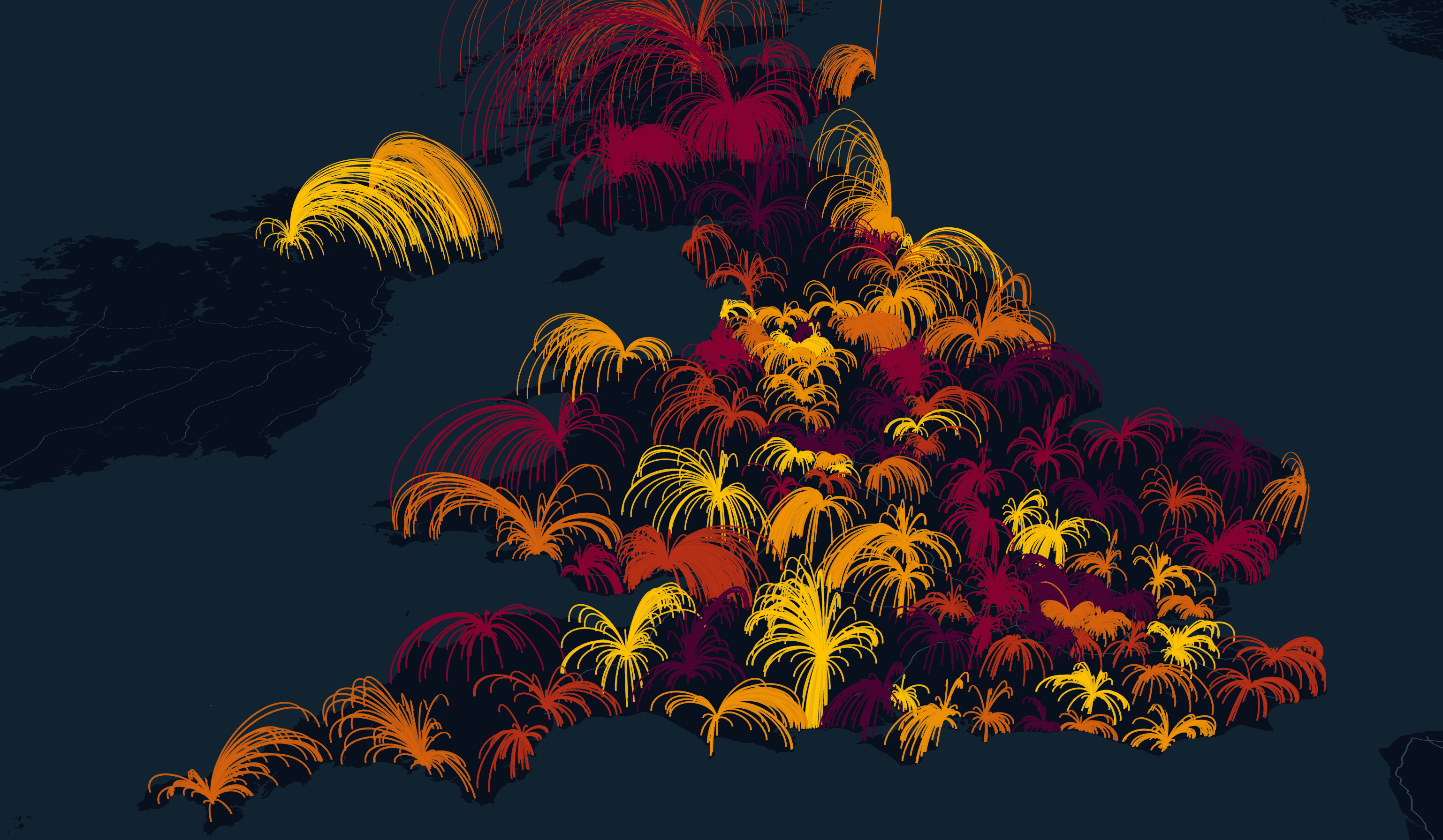
Franchise mapping assigns every UK postal sector to its nearest dealership by drive time, not crow-flies distance, so media territories follow how people actually travel.
We run a lot of franchise-based campaigns, mostly in Auto. The problem sounds simple on a slide — give every dealer their territory — and then you look at a map and realise rivers, estuaries and road networks do not care about straight-line distance.
Why drive time, not distance
We map every postal sector to its nearest dealership based on drive time. That is necessary because otherwise you get nonsense around rivers and estuaries. North Devon, for example, can look closer to South Wales than South Devon as the crow flies. Anyone who has actually driven that knows that is not how people travel.
I care about this because once you get the geography wrong, the media plan inherits the mistake. Dealers complain. Budgets land in the wrong catchment. You spend the rest of the campaign explaining a map rather than running ads.
Small budgets, big networks
Individual dealer budgets can sit below our normal campaign minimums. Across a large number of dealers, though, the sum becomes a proper campaign. The only way that works is if the geospatial side and the programmatic setup talk to each other — hundreds of line items, each with local geo-targeting and its own creative, without turning into a spreadsheet death march.
That is the bit I find interesting. The territory model is not just a pretty map. It is the input that makes a 100+ line-item franchise buy operationally possible.
What you are looking at
The visualisation above is the territories spat out of that drive-time assignment — postal sectors pulled to dealers the way a journey would actually go. It is not a finished product page. It is the working picture we use when we are arguing about whether a franchise network can be activated properly.
Related in the lab
Questions
Why drive time instead of crow-flies distance?
Rivers, estuaries and road networks break straight-line catchments. North Devon can look closer to South Wales than South Devon as the crow flies, which is not how people travel.
What does the map actually assign?
Every postal sector to its nearest dealership by drive time. That geography becomes the input for local geo-targeting across a large franchise network.